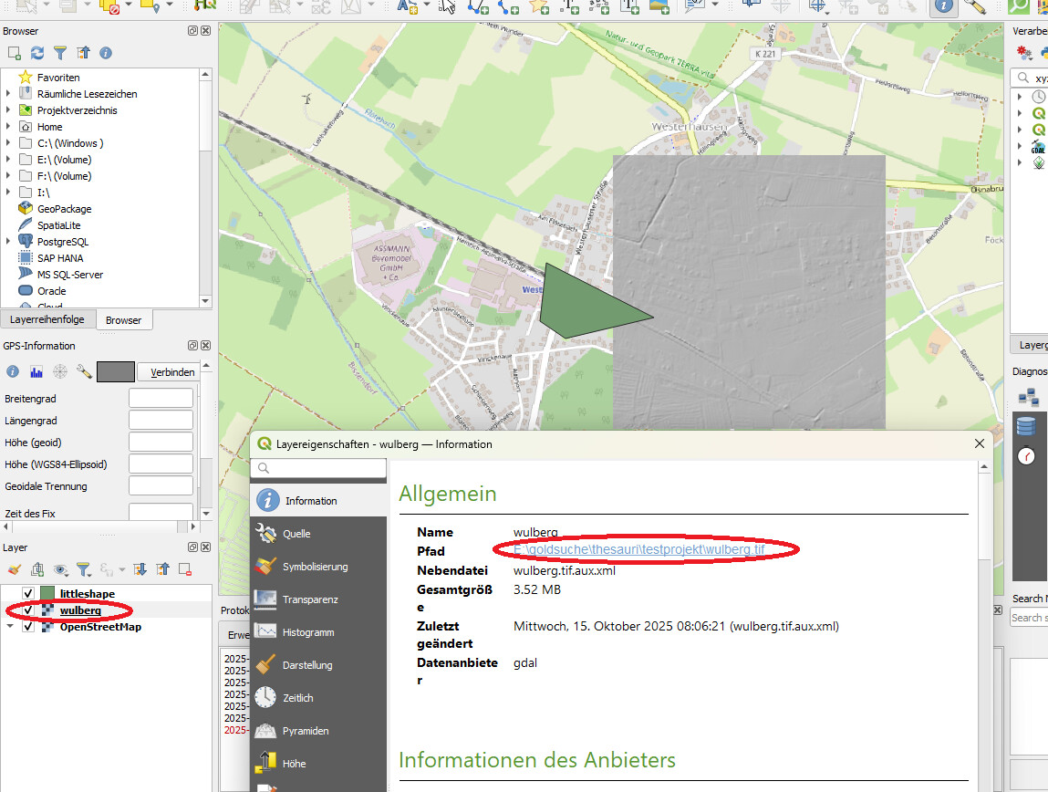
I have created a small testprojetct with OSM-Data, a rasterfile and a Shapefile.The Raster-file is called “Wulberg.tif”. You can see it in the screenshot:
Hi @KaiBehncke it looks like the raster file “wulberg.tif” was initially added from a folder that is configured as shared datasets in your QGIS settings. Can you check the list of folders that are in the “Settings” > “Options…” > “Data Sources” > “Localized Data Paths”?